| |
| ||||||
| U.S.S. Allen M. Sumner DD-692 | |||||||
| The Battle of Ormoc Bay Track Chart | |||||||
Ron Babuka accepted the challenge of creating a Track Chart of the Battle of Ormoc Bay. He first had to learn navigation and plotting followed by extensive research of the Action Reports, Ship's Logs and other records of the Battle. At that point he could finally put pen to paper. In September 2004, almost 5 years after the initial charts were done, Ron received the actual Track Chart created on the USS Moale (DD-693) thanks to Irwin "Pete" Kappes. The story of the Chart's history is related below. With this new information we present below a scan of the Moale's Track Chart and a composite chart that Ron created using all known information from all three ships.
|
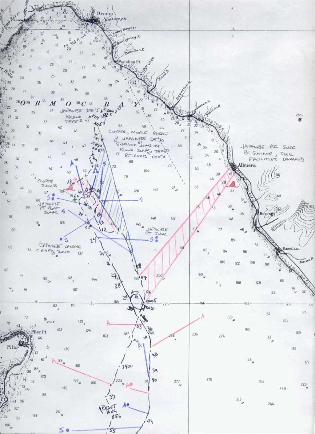
CHART LEGEND Destroyer Division 120 Targets Reading the Chart All bearings, times and ranges are presented as they appear in the Divisions records. The length of the line to a target is a representation of the number of yards (range) to the target and the angle of the line is the relative bearing of the target. The starting point of the line indicates which ship was taking action on the target and the time of occurrence is indicated in military time. The records of the Cooper did not survive the battle which makes it almost impossible to accurately track her actions and engagements. This chart is presented as accurately as can be
done with the data available. Sea conditions, wind speeds and
direction, time, actual ship/aircraft speeds and courses along with other variables
may be unknown, conflict with other data or are incomplete. Ron has done a masterful job on this difficult
assignment.
He has asked that anyone with additional knowledge please
contact him so that the chart may be updated. WRB - 9 September 2004 |
Composite track chart of Ormoc Bay Harbor created by Ron
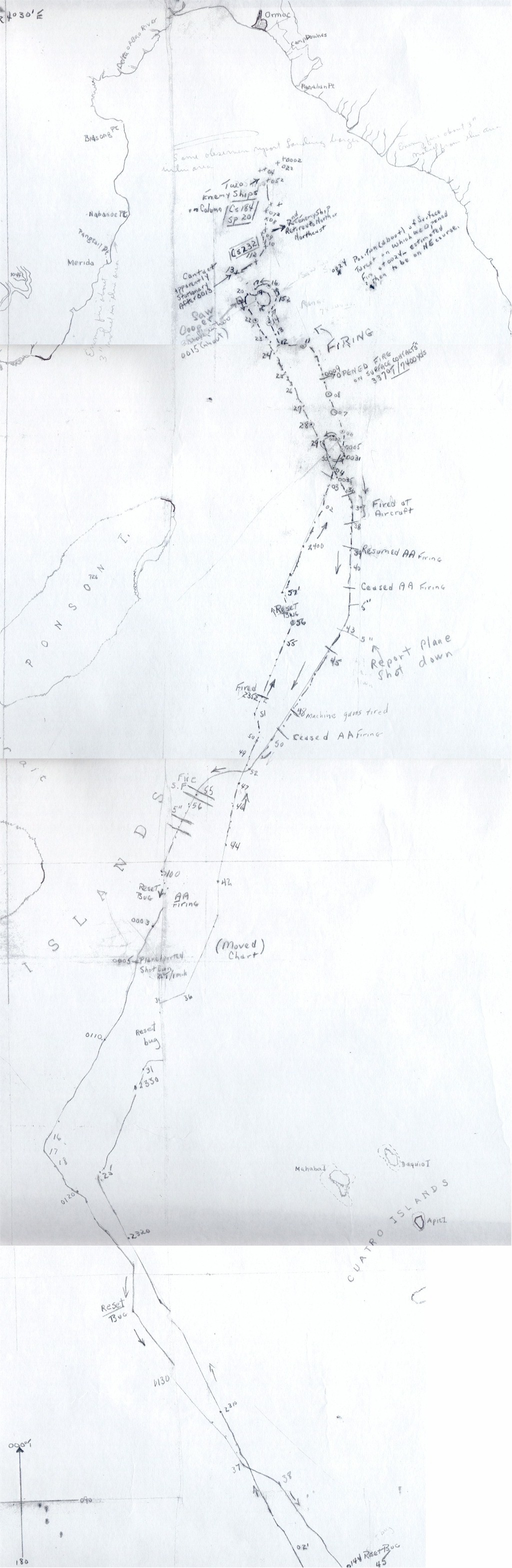
Babuka Actual Track Chart from the USS MOALE (DD-693) created by
Irv Wiggs during the battle |
The following is a brief note from "Pete" Kappes of the origin and history of the Moale Track Chart
I have great news! It's the kind of thing historians will give their right arms for---an original document---created at the time of a historical event and not just in its aftermath. Let me explain. Every tincan had a D.R. table in their CIC room. You probably know, but just in case you don't, that's a (roughly) 3'x6' table with a frosted glass top. Underneath, a point of strong light is projected upward from a moving spindle which is coordinated with the speed and direction of the ship and can be calibrated to indicate the ship's position on a map taped to the tabletop. In preparation for the battle, Irv Wiggs, our CIC officer, taped a Coast & Geodetic Survey map to the tabletop and then a sheet of tracing paper over that. As we moved into the Bay he traced every movement of the ship, along with notations as to time, activity, etc. I didn't even know this map (tracing) existed until a year or so ago. Irv turned the map over to Captain Foster after the battle and Foster kept it until a year before he died, after our second reunion. He apparently had a good sense of history and sent it to Wiggs who kept it all these years.